
A GORGE-OUS ADVENTURE: WAUNA POINT
The Columbia River Gorge National Scenic Area is home to many wonderful hikes – and one of my favorites is just a half-hour drive from Troutdale.
If you travel east on Interstate 84 past the Bonneville Dam you will come across the Eagle Creek recreation area. There are any trails accessible from Eagle Creek, but the focus here is on getting to the Wauna Viewpoint.
This is a fairly quick hike, clocking in at only around 3 miles roundtrip with a climb of 1,160 feet over the 1.5 miles to the top. The hike starts at the parking lot adjacent to the footbridge that will carry you over Eagle Creek.
[It is important to note that Eagle Creek Recreation Area requires a parking pass. You can either use a yearlong pass, such as the regional Northwest Forest trailhead pass or the nationwide America the Beautiful pass, or purchase a day pass (for $5). For a day pass, I would recommend purchasing the Digital Recreation pass before you leave your house as cell reception may be spotty once you enter the Gorge.]From the parking lot, cross the bridge and start your hike on the Gorge Trail. When I took the hike, trail conditions were mostly good, although they often change quickly. I encountered a few downed trees that I had to cross. Be careful as some parts of the trail are wet and slippery. As you ascend higher on the trail it will get rockier, so it is recommended that you wear sturdy shoes.
After 0.8 mile on the Gorge Trail, turn left onto Wauna Viewpoint trail. From there it is 0.75 mile to the top of the trail. Thankfully, the trails are well-marked so don’t worry about missing the turn. The trail will then start into switchbacks as you climb uphill, passing between electricity transmission towers.
From this point the trail can be a bit unstable, so my advice is be careful where you are stepping. One of the most nerve-wracking parts of this trail for me was just before I reached the top where I was walking across where it looked like there was a previous landslide. Some rocks fell from beneath my feet, but I made it across safely.
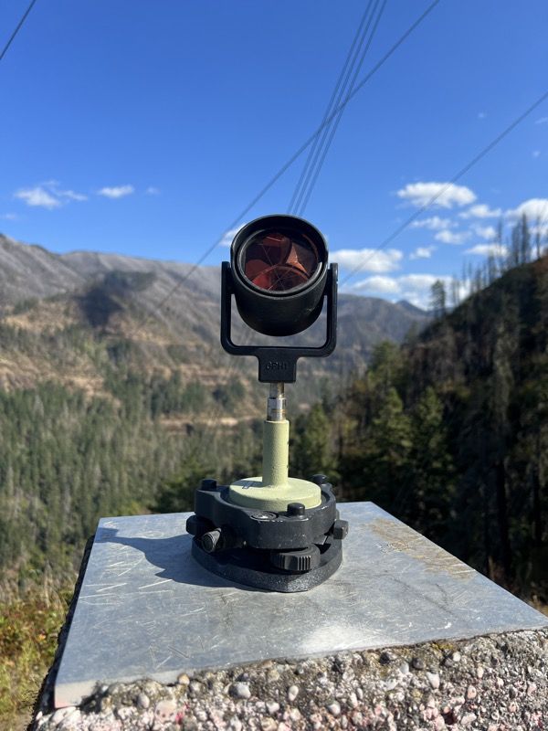
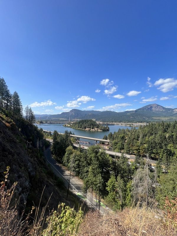
Once you reach the top you will be treated with a spectacular view, looking north towards the Columbia River and Washington State. You also can see Bonneville Dam which provides just under a million homes with electricity a year. The transmission lines that run along the end portion of the trail are actually owned and operated by the Bonneville Power Administration which delivers that power. Anyway, at the top there is an official geodesic survey marker, and at least when I was up there, a piece of surveying equipment that was pointing a prism up into the sky.
After taking in the wonderful views, it is a fairly easy descent back to the parking lot.
Overall, this is a fairly quick hike with a huge payoff. There are also many other hikes at the Eagle Creek Recreation Site, such as a hike to Punch Bowl falls via the Eagle Creek Trail. If you finish the Wauna hike and are wanting to do more, you can visit Bonneville Dam where you can see the fish hatchery and view the trout and sturgeon on display. There’s also the visitor center where you can learn more about the dam and how it operates.
For some more food, gas, or anything else you can drive a bit east into Cascade Locks to find what you need.
This is truly one of my favorite hikes because of short length and the wonderful view at the top.

News Editor
Leave a comment